Innovative Cultural Resource
Management Solutions, Worldwide
OVAI is also a SBA certified 8(a) firm, is a Women’s Business Enterprise (WBE/WBENC-certified), and Woman-Owned Small Business (WOSB/WBENC-certified).
Other Socio-economic Certifications: DBE (ODOT), MBE/EDGE (Ohio), SBA certified Small Business, and SBA Economically Disadvantaged Woman Owned (ED-WOSB).
GSA Contract Holder: GS-10F-172BA


Aerial Mapping & Photogrammetry
Unmanned Aerial Systems (UAS) and photogrammetry provide a relatively quick way to accurately map topographic landscapes and above-ground cultural resources. Photogrammetry models of buildings can be incorporated into CAD type programs, for measurement and alteration. High-resolution photogrammetry-based topographic models can be implemented in numerous GIS applications.
Geophysical Survey
Our geophysical survey specialists are well-rounded archaeologists with expertise in the use of magnetometry, ground-penetrating radar, electrical resistance, magnetic susceptibility, and other types of instrumentation. OVAI is a pioneer in the application and integration of geophysical survey with traditional archaeological investigation at the Phase I-III survey levels.
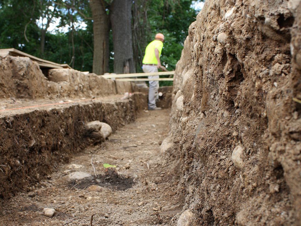
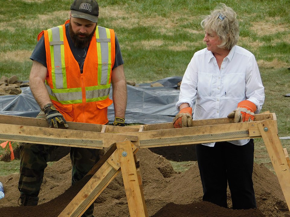
Archaeological Services & More
We specialize in the following: Traditional prehistoric and historic archaeology, above-ground cultural resources, historic military forts, historic and prehistoric cemeteries, prehistoric mounds and earthworks, archaeological field methods, archaeological site formation processes, prehistoric lithic technology, historic and prehistoric artifact analysis, historic and prehistoric pottery, artifact curation, and the development of research, survey and excavation plans.
Our Expertise
As a self-performing cultural resource management firm, OVAI has successfully completed over 1,000 projects for a wide variety of federal, state, and local agencies, as well as private sector clients throughout the United States and in several foreign countries. OVAI’s professional staff is well regarded for its expertise in prehistoric and historic archaeology, historic military forts, historic and prehistoric cemeteries, prehistoric mounds and earthworks, and above-ground cultural resources.
In addition to traditional historic preservation, OVAI also boasts one of the most comprehensive archaeological geophysical (remote sensing) programs in the United States. Our expertise includes the use of magnetometry, ground-penetrating radar, electrical resistance, magnetic susceptibility, and other types of instrumentation. Likewise, our aerial UAV 3D model and photogrammetry program is gaining considerable attention as a means for efficiently documenting and mapping above ground cultural resources in the US and abroad.
Our Philosophy
To us, history and archaeology are exciting. OVAI is staffed by people who have made archaeology a career. We like to think outside the box. We are relentless in our endeavor to find better ways of doing our jobs: to collect, document, and explain cultural resources in the most efficient and effective ways possible.
We also understand that many of our clients view NHPA compliance as a potential obstacle to their projects. We strive to make our role in the compliance process as painless as possible, and we are always more than happy to provide guidance and assistance.
Our State-of-the-Art Technology
OVAI integrates state-of-the-art technology with traditional approaches to better identify, document, and evaluate cultural resources effectively and efficiently. The combined use of archaeo-geophysics, photogrammetry, GIS, and minimal ground-truthing yields a more comprehensive understanding of archaeological resources than traditional approaches alone. This improves the quality of archaeological evaluation at an early stage and is beneficial for time/cost reduction and planning.
Unmanned Aerial Systems (UAS) and photogrammetry provide a relatively quick way to accurately map topographic landscapes and historic buildings. Photogrammetry models of buildings can be incorporated into CAD type programs for accurate measurement and alteration. High-resolution photogrammetry-based topographic models can be implemented in numerous GIS applications to conduct terrain analysis, calculate volumes, and find subtle surface features that are otherwise imperceptible. UAS-based photogrammetry has also proven effective for accurately mapping complex landscapes, such as cemeteries.
Featured
“The Mary Worthington Macomb House, built circa 1800, was bought by Thomas Worthington, the 6th governor of Ohio, for use by his daughter Mary. Though smaller and simpler than the Adena Mansion, Worthington’s personal home, the Macomb House shares a similar style in its stone construction. The video here is an animation of the 3D model built with photogrammetry and drone-based photographs.”
The Last Great Escape
In the spring of 2021, OVAI had the opportunity to share results of their work to help recover the remains of 1st Lt. Ewart Sconiers, who died in 1942 as a World War II POW in Poland. Click here to explore OVAI’s poster presented at the 86th Annual Society for American Archaeology conference as part of the session “Applying the Power of Partnerships to the Search for America’s Missing in Action.”

News & Research
Gist Settlement
Ohio was a battleground state before the Civil War for people of color, especially those seeking freedom and those who had been freed through manumission. A multi-year collaborative project between OVAI and Mr. Paul LaRue’s Research History class at Washington Senior...
Lt. Ewart Sconiers WWII POW/MIA Recovery Project
In August of 2015, OVAI was contracted under DPAA (Defense POW/MIA Accounting Agency) to conduct geophysical survey and excavate two 3x8 meter trenches (ca. two dozen graves) in Allies Park, Lubin, Poland in search of 1st Lt. Ewart Sconiers. Lt. Sconiers was a WWII...
New Earthwork Located at Hopewell Hilltop
OVAI and Ohio Historical Society archaeologists located a new earthwork inside the walls of the Hopewell hilltop enclosure at Fort Ancient, which was built about 1700-1800 years ago. For more information go to the Ohio Historical Society website and search on Fort...
Ohio Valley Archaeology, Inc.
4889 Sinclair Road, Suite 210
Columbus, Ohio 43229
Telephone: (614) 436-6926
Fax: (614) 436-6945
STAY CONNECTED
![]()
![]()
![]()
![]()
![]()